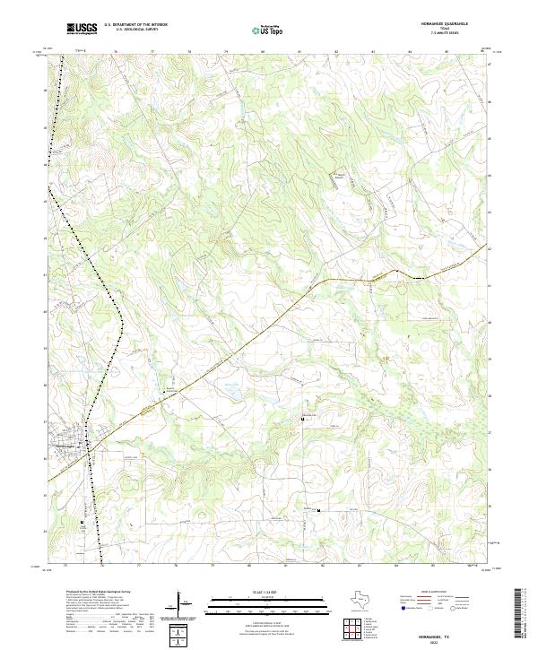
2022 Map of Normangee
USGS Topo · Published 2022About this map
Old San Antonio Rd bisects this landscape, tracking along the boundary between Leon and Madison Counties and serving as the primary corridor for the town of Normangee. The map reveals a rural topography defined by small-scale cattle and ranching operations, such as the 16 L Ranch Airport north of Deadman Hollow Br. For genealogists, the terrain is marked by several significant burial sites, including Rogers Prairie Cem and Sand Prairie Cem, which sit alongside the western agricultural roads. The drainage pattern is heavily localized, with numerous small tributaries like Salt Creek and East Coney Creek feeding into man-made catchments like Soil Conservation Service Site 1 Reservoir. This layout suggests a long-standing reliance on local water management to support the dispersed farms and residential loops that branch off the main transit routes.
Find a feature on this map
67 named features on this map. Tap any name to fly to it.
Don’t see what you’re looking for? This feature index may not catch every label — zoom into the map to look around manually.
Map Details
Editions of this 2022 Normangee Map
This is the sole edition of this map. No revisions or reprints were ever made.
Other maps of this area

1925 · Iola No 2
USGS Topo · 1:48,000

1931 · Iola
USGS Topo · 1:62,500

1953 · Palestine
USGS Topo · 1:250,000

1954 · Waco
USGS Topo · 1:250,000

1954 · Beaumont
USGS Topo · 1:250,000

1954 · Austin
USGS Topo · 1:250,000

1955 · Waco
USGS Topo · 1:250,000

1957 · Beaumont
USGS Topo · 1:250,000

1957 · Palestine
USGS Topo · 1:250,000

1963 · Madisonville
USGS Topo · 1:24,000