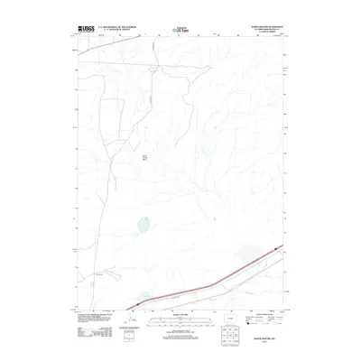
2012 Map of North Baxter
USGS Topo · Published 2012About this map
North Baxter stands as a focal point in this high-desert corridor of Sweetwater County, where the landscape is defined by the broad depressions of the North Baxter Basin. The map records a critical transportation artery through the Wyoming interior, where the modern I80 Service Rd runs parallel to the drainage of Bitter Cr. This waterway, along with Salt Wells Cr, illustrates the drainage patterns essential to the region's ranching and transit history. The layout of N Baxter Rd reaching northward highlights the sparse but vital infrastructure connecting these desert basins to the larger regional network. This 2012 survey provides a precise look at the land before further industrial or infrastructure changes, serving as a reliable reference for those tracking the modern evolution of these high-plains settlements.
Find a feature on this map
6 named features on this map. Tap any name to fly to it.
Don’t see what you’re looking for? This feature index may not catch every label — zoom into the map to look around manually.
Map Details
Editions of this 2012 North Baxter Map
This is the sole edition of this map. No revisions or reprints were ever made.
Other maps of this area

1908 · Rock Springs
USGS Topo · 1:62,500

1910 · Rock Springs
USGS Topo · 1:62,500

1954 · Rock Springs
USGS Topo · 1:250,000

1958 · Rock Springs
USGS Topo · 1:250,000

1958 · Boars Tusk
USGS Topo · 1:62,500

1958 · Superior
USGS Topo · 1:62,500

1962 · Rock Springs
USGS Topo · 1:250,000

1968 · North Baxter
USGS Topo · 1:24,000

1968 · Point Of Rocks SW
USGS Topo · 1:24,000
1968 · Rock Springs
USGS Topo · 1:24,000