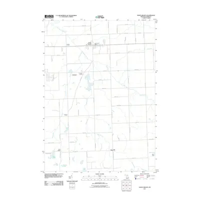
2011 Map of North Branch
USGS Topo · Published 2011About this map
The North Branch Flint River winds through the northern portion of this Lapeer County landscape, anchoring the village of North Branch. The town serves as a local hub, featuring the North Branch Post Office and Westlawn Cemetery at its western edge. To the south, the terrain becomes increasingly dotted with small lakes and marshy lowlands, most notably around the settlement of Five Lakes where Bear Lake, Duperow Lake, and Five Lakes Cemetery are located.
Find a feature on this map
59 named features on this map. Tap any name to fly to it.
Don’t see what you’re looking for? This feature index may not catch every label — zoom into the map to look around manually.
Map Details
Editions of this 2011 North Branch Map
This is the sole edition of this map. No revisions or reprints were ever made.
Other maps of this area

1954 · Flint
USGS Topo · 1:250,000

1958 · Flint
USGS Topo · 1:250,000

1963 · Clifford
USGS Topo · 1:24,000

1963 · Attica
USGS Topo · 1:24,000

1963 · Mayville
USGS Topo · 1:24,000

1963 · Marlette
USGS Topo · 1:24,000

1963 · North Branch
USGS Topo · 1:24,000

1963 · Burnside
USGS Topo · 1:24,000
1963 · Imlay City
USGS Topo · 1:24,000
1963 · Barnes Lake
USGS Topo · 1:24,000