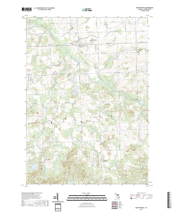
2023 Map of North Branch
USGS Topo · Published 2023About this map
The North Branch Flint River anchors the drainage network of this Lapeer County landscape, where the village of North Branch sits at the intersection of a sprawling system of agricultural drains and creeks. To the south, the terrain transitions into a more lacustrine environment, featuring water bodies such as Five Lakes and Bear Lake, alongside the smaller Duperow Lake and Cedar Lake.
Find a feature on this map
65 named features on this map. Tap any name to fly to it.
Don’t see what you’re looking for? This feature index may not catch every label — zoom into the map to look around manually.
Map Details
Editions of this 2023 North Branch Map
This is the sole edition of this map. No revisions or reprints were ever made.
Other maps of this area

1954 · Flint
USGS Topo · 1:250,000

1958 · Flint
USGS Topo · 1:250,000

1963 · Clifford
USGS Topo · 1:24,000

1963 · Attica
USGS Topo · 1:24,000

1963 · Mayville
USGS Topo · 1:24,000

1963 · Marlette
USGS Topo · 1:24,000

1963 · North Branch
USGS Topo · 1:24,000

1963 · Burnside
USGS Topo · 1:24,000
1963 · Imlay City
USGS Topo · 1:24,000
1963 · Barnes Lake
USGS Topo · 1:24,000
Featured Places
- North Branch, MI
- Mayfield Township, MI
- Arcadia Township, MI
- Burlington Township, MI
- Deerfield Township, MI