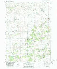
1982 Map of North Henderson
USGS Topo · Published 1983About this map
The Burlington Northern railroad corridor anchors this survey of western Illinois, connecting the rural communities of North Henderson and Rio during the early 1980s. This agricultural landscape is deeply etched by the drainage systems of North Henderson Creek, Middle Henderson Creek, and South Henderson Creek, which create pockets of varied terrain amidst the structured grid of the Fourth Principal Meridian.
Find a feature on this map
32 named features on this map. Tap any name to fly to it.
Don’t see what you’re looking for? This feature index may not catch every label — zoom into the map to look around manually.
Map Details
Editions of this 1982 North Henderson Map
This is the sole edition of this map. No revisions or reprints were ever made.
Other maps of this area

1921 · Monmouth
USGS Topo · 1:62,500

1923 · Monmouth
USGS Topo · 1:62,500

1923 · Alexis
USGS Topo · 1:62,500

1925 · Alexis
USGS Topo · 1:62,500

1925 · Galesburg
USGS Topo · 1:62,500

1927 · Galesburg
USGS Topo · 1:62,500

1947 · Woodhull
USGS Topo · 1:62,500

1953 · Woodhull
USGS Topo · 1:24,000

1953 · Viola
USGS Topo · 1:24,000
1953 · New Windsor
USGS Topo · 1:24,000