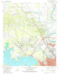
1980 Map of North Highlands
USGS Topo · Published 1986About this map
The Red River and the sweeping waters of Cross Lake anchor this 1980 study of the northern corridor of Shreveport. The landscape is a transition from the industrial and educational hubs along Cooper Road, including the Southern University campus, to the residential expansions of North Highlands and Lake View. The northern reaches are characterized by the winding Twelvemile Bayou and the Sentell Oil and Gas Field, indicating the region's long-standing energy infrastructure. Notable for genealogists, the map identifies numerous neighborhood landmarks such as Oakland Cem, Light Hill Cem, and several local congregations like Bethel Ch and St Matthew Ch. The presence of the Kansas City Southern and Pacific railroads reveals the transit-oriented development that historically linked these communities to the larger river economy.
Find a feature on this map
67 named features on this map. Tap any name to fly to it.
Don’t see what you’re looking for? This feature index may not catch every label — zoom into the map to look around manually.
Map Details
Editions of this 1980 North Highlands Map
3 editions found
Other maps of this area

1932 · Bossier SW
USGS Topo · 1:31,680

1932 · Shreveport SE
USGS Topo · 1:31,680

1932 · Bossier NW
USGS Topo · 1:31,680

1932 · Shreveport NE
USGS Topo · 1:31,680

1941 · Forbing
USGS Topo · 1:31,680

1945 · Greenwood
USGS Topo · 1:62,500

1948 · Mooringsport
USGS Topo · 1:62,500

1948 · Bossier City
USGS Topo · 1:62,500

1948 · Caspiana
USGS Topo · 1:62,500

1955 · Shreveport
USGS Topo · 1:250,000