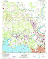
1980 Map of North Highlands
USGS Topo · Published 1992About this map
The Red River and the complex waterways of Cross Lake define this 1980s landscape north of Shreveport. The map illustrates a period of significant suburban expansion and institutional development, particularly evident in the presence of Southern University and numerous educational facilities like Northwood High Sch and Linear Jr High Sch. Industrial activity is centered on the Sentell Oil and Gas Field and the Kansas City Southern RR, which cuts diagonally through the terrain.
Find a feature on this map
76 named features on this map. Tap any name to fly to it.
Don’t see what you’re looking for? This feature index may not catch every label — zoom into the map to look around manually.
Map Details
Editions of this 1980 North Highlands Map
3 editions found
Other maps of this area

1932 · Bossier SW
USGS Topo · 1:31,680

1932 · Shreveport SE
USGS Topo · 1:31,680

1932 · Bossier NW
USGS Topo · 1:31,680

1932 · Shreveport NE
USGS Topo · 1:31,680

1941 · Forbing
USGS Topo · 1:31,680

1945 · Greenwood
USGS Topo · 1:62,500

1948 · Mooringsport
USGS Topo · 1:62,500

1948 · Bossier City
USGS Topo · 1:62,500

1948 · Caspiana
USGS Topo · 1:62,500

1955 · Shreveport
USGS Topo · 1:250,000