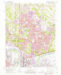
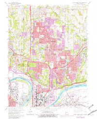
1964 Map of North Kansas City
USGS Topo · Published 1976About this map
The Missouri River and its industrial floodplains define the southern landscape of this mid-1970s record, where the Kansas City Municipal Airport and massive rail yards for the Union Pacific and Burlington Northern dominate the river bends. North of the city center, the terrain rises into suburban expansions shown in purple, marking the growth of Gladstone and surrounding townships like Gallatin and Pettis. This era captures a transition from rural crossroads like Barry and Gashland to a more densely connected metropolitan corridor.
Find a feature on this map
91 named features on this map. Tap any name to fly to it.
Don’t see what you’re looking for? This feature index may not catch every label — zoom into the map to look around manually.
Map Details
Editions of this 1964 North Kansas City Map
5 editions found
Other maps of this area

1890 · Kansas City
USGS Topo · 1:125,000

1894 · Kansas City
USGS Topo · 1:125,000

1894 · Independence
USGS Topo · 1:125,000

1914 · Smithville
USGS Topo · 1:62,500

1934 · Independence
USGS Topo · 1:24,000

1934 · Shawnee
USGS Topo · 1:24,000

1935 · Kansas City
USGS Topo · 1:24,000

1935 · North Kansas City
USGS Topo · 1:24,000

1935 · Liberty
USGS Topo · 1:24,000

1936 · Kearney
USGS Topo · 1:48,000