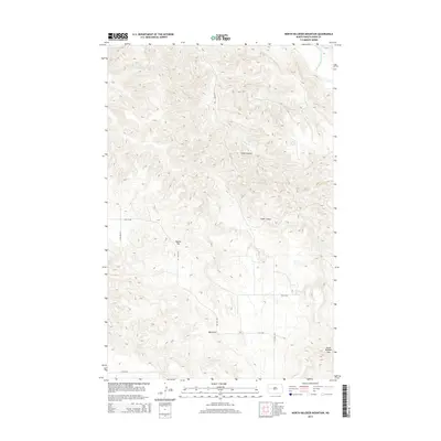
2014 Map of North Killdeer Mountain
USGS Topo · Published 2014About this map
North Killdeer Mtn anchors the southeastern corner of this landscape in Dunn County, rising above a complex network of drainages and plateau formations. The Little Missouri River cuts across the northeast, establishing a hydrologic boundary for the deeply eroded badlands terrain. Significant geographic markers like Round Top and the Big Gulch break the high prairie, while seasonal watercourses including Bear Cr and Chase Cr have carved prominent features like Cedar Coulee. This U.S. Geological Survey representation shows the section-line road system, including 7th St NW and 113th Ave NW, which provides the primary access through these cattle-ranching uplands. The map illustrates the characteristic North Dakota high plains topography where flat tablelands drop sharply into coulees and ravines.
Find a feature on this map
16 named features on this map. Tap any name to fly to it.
Don’t see what you’re looking for? This feature index may not catch every label — zoom into the map to look around manually.
Map Details
Editions of this 2014 North Killdeer Mountain Map
This is the sole edition of this map. No revisions or reprints were ever made.
Other maps of this area

1953 · Watford City
USGS Topo · 1:250,000

1957 · Watford City
USGS Topo · 1:250,000

1958 · Lone Butte SE
USGS Topo · 1:24,000

1958 · North Killdeer Mountain
USGS Topo · 1:24,000

1959 · Croff
USGS Topo · 1:24,000

1959 · Lone Butte NE
USGS Topo · 1:24,000

1967 · Watford City
USGS Topo · 1:250,000

1970 · Lost Bridge
USGS Topo · 1:24,000

1970 · Figure 4 Ranch
USGS Topo · 1:24,000

1974 · Killdeer
USGS Topo · 1:100,000