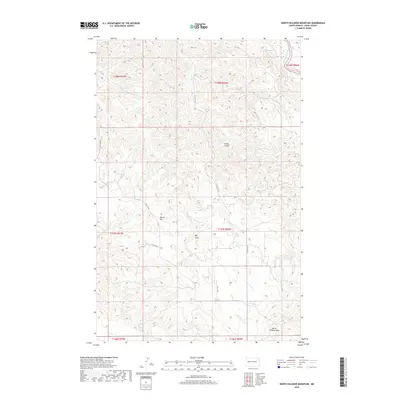
2018 Map of North Killdeer Mountain
USGS Topo · Published 2018About this map
North Killdeer Mtn anchors the southern reaches of this Dunn County landscape, rising prominently above a network of drainages and coulees. The map details a high-relief environment where the Little Missouri River cuts through the northeast corner, creating a stark contrast to the surrounding tablelands. Inland, the terrain is defined by dramatic features like Round Top and the deep incision of Big Gulch. A sparse grid of local roads, including 114th Ave NW and 13th M St NW, navigates the complex topography of these badlands. The drainage pattern is led by Bear Cr and Chase Cr, which channel runoff through eroded valleys such as Cedar Coulee, illustrating the erosional forces that have shaped this portion of the northern plains.
Find a feature on this map
19 named features on this map. Tap any name to fly to it.
Don’t see what you’re looking for? This feature index may not catch every label — zoom into the map to look around manually.
Map Details
Editions of this 2018 North Killdeer Mountain Map
This is the sole edition of this map. No revisions or reprints were ever made.
Other maps of this area

1953 · Watford City
USGS Topo · 1:250,000

1957 · Watford City
USGS Topo · 1:250,000

1958 · Lone Butte SE
USGS Topo · 1:24,000

1958 · North Killdeer Mountain
USGS Topo · 1:24,000

1959 · Croff
USGS Topo · 1:24,000

1959 · Lone Butte NE
USGS Topo · 1:24,000

1967 · Watford City
USGS Topo · 1:250,000

1970 · Lost Bridge
USGS Topo · 1:24,000

1970 · Figure 4 Ranch
USGS Topo · 1:24,000

1974 · Killdeer
USGS Topo · 1:100,000