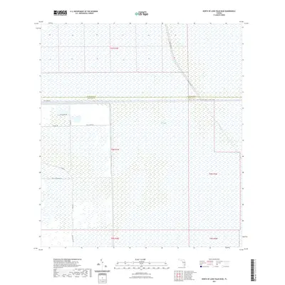
2021 Map of North of Lone Palm Head
USGS Topo · Published 2021About this map
The Everglades dominate this 2021 landscape along the Palm Beach Co Broward Co boundary, revealing the structured intersection of wilderness and modern infrastructure. The Miami Canal serves as a primary hydrological and navigational spine, flanked by the industrial access of Miami Canal Rd. This portion of the wetland is managed through an intricate network of service roads and trails, including the Canal Maintenance Rd and specialized routes like Canal E Mine Trl and W Mine Trl. These roads, along with Rock Quarry Rd and Airport Rd, suggest a landscape defined by water management and resource extraction. The southern portion of the sheet is anchored by the transit corridors of Snake Rd and Josie Billie Hwy, providing critical links through the interior marshland.
Find a feature on this map
17 named features on this map. Tap any name to fly to it.
Don’t see what you’re looking for? This feature index may not catch every label — zoom into the map to look around manually.
Map Details
Editions of this 2021 North of Lone Palm Head Map
This is the sole edition of this map. No revisions or reprints were ever made.
Other maps of this area

1956 · West Palm Beach
USGS Topo · 1:250,000

1957 · West Palm Beach
USGS Topo · 1:250,000

1958 · West Palm Beach
USGS Topo · 1:250,000

1973 · Everglades 4 NW
USGS Topo · 1:24,000

1973 · Everglades 3 NE
USGS Topo · 1:24,000

1974 · Everglades 1 SW
USGS Topo · 1:24,000

1974 · Everglades 2 SW
USGS Topo · 1:24,000

1974 · Everglades 2 SE
USGS Topo · 1:24,000

1974 · Everglades 1 NW
USGS Topo · 1:24,000
1974 · Everglades 2 NW
USGS Topo · 1:24,000