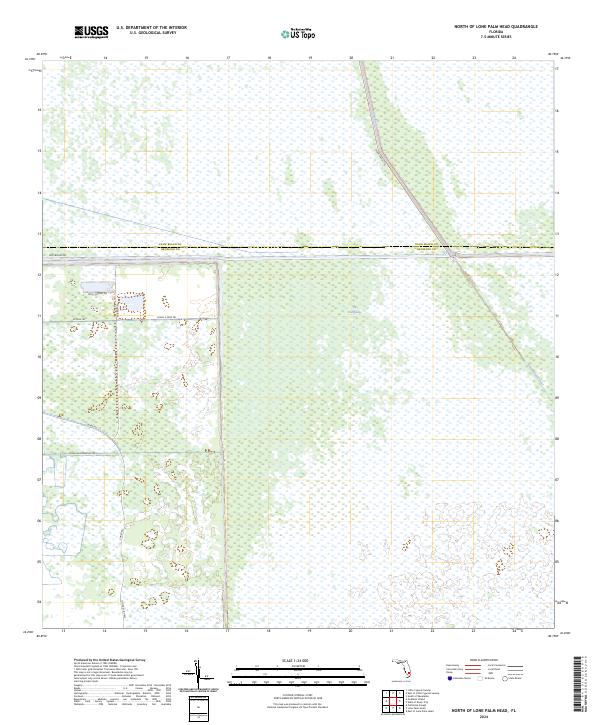
2024 Map of North of Lone Palm Head
USGS Topo · Published 2024About this map
The Everglades dominate this 2024 landscape along the jurisdictional boundary of Palm Beach Co and Broward Co. The map documents a critical intersection of water management and transportation infrastructure in southern Florida, anchored by the prominent Miami Canal and its parallel thoroughfare, Miami Canal Rd. While much of the terrain is defined by the marshy expanse of the Everglades, localized industrial and transit features appear in the western half of the sheet. Modern connectivity is represented by the Josie Billie Hwy and Snake Rd, while specialized routes like Rock Quarry Rd, W Mine Trl, and Canal E Mine Trl indicate the specific land uses and resource extraction sites situated between the wetlands and the canal system.
Find a feature on this map
17 named features on this map. Tap any name to fly to it.
Don’t see what you’re looking for? This feature index may not catch every label — zoom into the map to look around manually.
Map Details
Editions of this 2024 North of Lone Palm Head Map
This is the sole edition of this map. No revisions or reprints were ever made.
Other maps of this area

1956 · West Palm Beach
USGS Topo · 1:250,000

1957 · West Palm Beach
USGS Topo · 1:250,000

1958 · West Palm Beach
USGS Topo · 1:250,000

1973 · Everglades 4 NW
USGS Topo · 1:24,000

1973 · Everglades 3 NE
USGS Topo · 1:24,000

1974 · Everglades 1 SW
USGS Topo · 1:24,000

1974 · Everglades 2 SW
USGS Topo · 1:24,000

1974 · Everglades 2 SE
USGS Topo · 1:24,000

1974 · Everglades 1 NW
USGS Topo · 1:24,000
1974 · Everglades 2 NW
USGS Topo · 1:24,000