
1973 Map of North of Volt
USGS Topo · Published 1995About this map
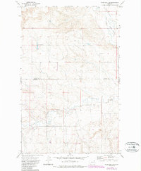
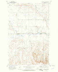
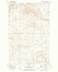
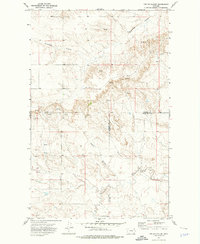
The Fort Peck Indian Reservation dominates this northern landscape where the West Fork Poplar River carves through the undulating terrain. This 1970s survey captures a transition in the land's use, where agricultural storage and industrial extraction sit side-by-side with tribal lands. The northern portion of the map is marked by the border between Daniels and Roosevelt counties, crossing over high points and shallow drainages. Evidence of resource exploration and local infrastructure is scattered across the township, from a single Drill Hole in the center to clusters of Storage Bins used for local grain. Further south, the meandering path of Cottonwood Creek provides a stark contrast to the rigid section lines that divide the surrounding plains. The presence of a Well and a Gravel Pit along the eastern edge highlights the small-scale developments supporting this rural stretch of eastern Montana.
Find a feature on this map
8 named features on this map. Tap any name to fly to it.
Don’t see what you’re looking for? This feature index may not catch every label — zoom into the map to look around manually.
Map Details
Editions of this 1973 North of Volt Map
3 editions found
Other maps of this area

1910 · Todd Lakes
USGS Topo · 1:62,500
1915 · Tule Valley
USGS Topo · 1:62,500

1915 · Todd Lakes
USGS Topo · 1:62,500

1954 · Wolf Point
USGS Topo · 1:250,000

1958 · Wolf Point
USGS Topo · 1:250,000
1973 · Peerless 4 NE
USGS Topo · 1:24,000
1973 · West Fork NE
USGS Topo · 1:24,000
1973 · Peerless 4 SE
USGS Topo · 1:24,000
1973 · Peerless 4 SW
USGS Topo · 1:24,000
1973 · Poplar Coulee
USGS Topo · 1:24,000