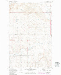
1973 Map of Peerless 4 SW
USGS Topo · Published 1989About this map
The rolling grasslands of the northern high plains are defined here by the West Fork Poplar River as it winds through the northeastern reaches of the map. This 1970s landscape, later updated in the 1980s, reflects an agricultural economy centered on seasonal storage, evidenced by numerous Storage Bins and a Grain Bin scattered across the upland sections. The terrain is marked by the distinct boundary line between Daniels Co and Roosevelt Co, illustrating the jurisdictional divisions of the Fort Peck Indian Reservation.
Find a feature on this map
9 named features on this map. Tap any name to fly to it.
Don’t see what you’re looking for? This feature index may not catch every label — zoom into the map to look around manually.
Map Details
Editions of this 1973 Peerless 4 SW Map
3 editions found
Other maps of this area

1910 · Todd Lakes
USGS Topo · 1:62,500

1915 · Tule Valley
USGS Topo · 1:62,500

1915 · Todd Lakes
USGS Topo · 1:62,500

1954 · Wolf Point
USGS Topo · 1:250,000

1958 · Wolf Point
USGS Topo · 1:250,000

1973 · Peerless 4 NE
USGS Topo · 1:24,000

1973 · West Fork NE
USGS Topo · 1:24,000

1973 · Peerless 4 SE
USGS Topo · 1:24,000

1973 · Peerless 4 SW
USGS Topo · 1:24,000

1973 · Poplar Coulee
USGS Topo · 1:24,000