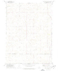
1972 Map of North Platte 2 NW
USGS Topo · Published 1975About this map
Isolated cattle ranches define this high plains landscape along the border of McPherson and Lincoln counties in the early 1970s. The terrain is marked by the presence of widely spaced homesteads such as The Old Homestead Ranch, Pullen Ranch, and Connell Ranch, which appear as small clusters of activity in an otherwise open expanse. In the southern portion of the sheet, the Hoban Ranch sits near the county line, while a solitary Well is noted to the north. This survey is particularly useful for identifying specific fence and field lines, which were recorded from aerial photographs to show the exact boundaries of land use during this era. The lack of towns or public infrastructure highlights the ranch-driven economy of this portion of Nebraska.
Find a feature on this map
6 named features on this map. Tap any name to fly to it.
Don’t see what you’re looking for? This feature index may not catch every label — zoom into the map to look around manually.
Map Details
Editions of this 1972 North Platte 2 NW Map
2 editions found
Other maps of this area

1898 · Paxton
USGS Topo · 1:125,000

1899 · North Platte
USGS Topo · 1:125,000

1901 · Paxton
USGS Topo · 1:125,000

1902 · North Platte
USGS Topo · 1:125,000

1949 · Wright Valley
USGS Topo · 1:62,500

1951 · Tryon
USGS Topo · 1:62,500

1951 · Wright Valley
USGS Topo · 1:62,500

1954 · North Platte
USGS Topo · 1:250,000

1956 · North Platte
USGS Topo · 1:250,000

1957 · North Platte
USGS Topo · 1:250,000