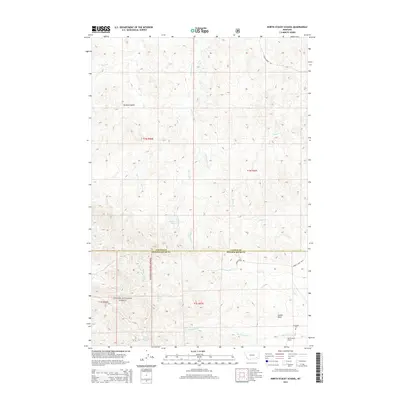
2014 Map of North Stacey School
USGS Topo · Published 2014About this map
The Custer National Forest boundary crosses this portion of Powder River County, where the high plains landscape is defined by a dense network of coulees and seasonal drainages. In the southern reaches of the map, the small community of N Stacey serves as a focal point for local history, anchored by the North Stacey School and the N Stacey Cem. These features, along with prominent landmarks like Castle Rock, reflect the rural settlement patterns that have persisted in this part of Montana for generations.
Find a feature on this map
25 named features on this map. Tap any name to fly to it.
Don’t see what you’re looking for? This feature index may not catch every label — zoom into the map to look around manually.
Map Details
Editions of this 2014 North Stacey School Map
This is the sole edition of this map. No revisions or reprints were ever made.
Other maps of this area

1954 · Hardin
USGS Topo · 1:250,000

1954 · Ekalaka
USGS Topo · 1:250,000

1956 · Ekalaka
USGS Topo · 1:250,000

1957 · Hardin
USGS Topo · 1:250,000

1958 · Ekalaka
USGS Topo · 1:250,000

1958 · Hardin
USGS Topo · 1:250,000

1965 · Ekalaka
USGS Topo · 1:250,000
1966 · Stacey
USGS Topo · 1:24,000
1966 · Beaver Creek School
USGS Topo · 1:24,000
1966 · Elk Ridge
USGS Topo · 1:24,000