1957 Map of North Vernon
USGS Topo · Published 1958About this map
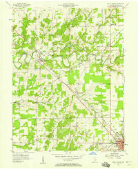
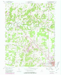
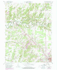
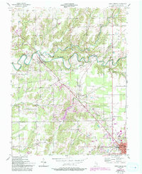
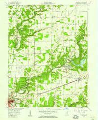
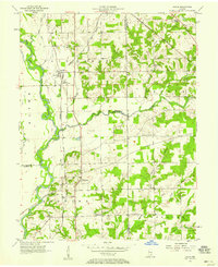
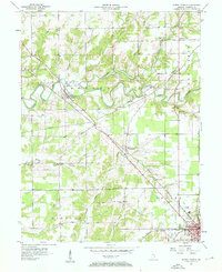
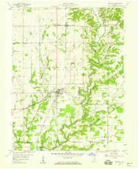
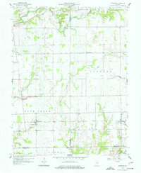
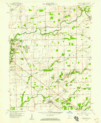
Sand Creek snakes across this Jennings County landscape, defined by a distinct diagonal rail corridor and the historic Treaty Line that cuts through the northern townships. The settlement at Scipio serves as a focal point where the Pennsylvania railroad crosses the water near a Covered Bridge. This mid-century survey captures a rural environment in transition, where established community landmarks like Pleasant View Ch and Oak Grove Cem sit alongside newer developments like the Drive-in Theater near the southern edge of the sheet. In North Vernon, the convergence of the Baltimore and Ohio railroad and the Armory reflects the town's role as a regional hub. The map provides a clear view of the sprawling creek systems, including Mutton Creek and Wyaloosing Creek, which shaped the early settlement patterns of Geneva and Center townships.
Find a feature on this map
37 named features on this map. Tap any name to fly to it.
Don’t see what you’re looking for? This feature index may not catch every label — zoom into the map to look around manually.
Map Details
Editions of this 1957 North Vernon Map
5 editions found
Other maps of this area

1942 · Columbus
USGS Topo · 1:125,000

1953 · Cincinnati
USGS Topo · 1:250,000

1956 · Louisville
USGS Topo · 1:250,000

1957 · Cincinnati
USGS Topo · 1:250,000
1957 · Butlerville
USGS Topo · 1:24,000
1957 · Azalia
USGS Topo · 1:24,000
1957 · North Vernon
USGS Topo · 1:24,000
1958 · Westport
USGS Topo · 1:24,000
1958 · Grammer
USGS Topo · 1:24,000
1958 · Elizabethtown
USGS Topo · 1:24,000