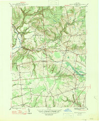
1947 Map of North Western
USGS Topo · Published 1947About this map
North Western and the small hamlet of Frenchville are centered in this post-war landscape of Oneida County, where the Mohawk River and Big Brook carve through high upland terrain. The map documents a rural society structured around local landmarks like South Hill School and Gifford Hill School, alongside several family and community burial grounds including Penn Mtn Cemetery and Nesbitt Cemetery. This survey shows the early mid-century road network, including State Route 46 and State Route 26, connecting the larger townships of Western, Steuben, and Floyd. The detailed topography highlights numerous named summits such as Maple Mountain and Starr Hill, illustrating the transition from the river valleys to the surrounding heights. Genealogists will find particular value in the clearly marked locations of Merrick Corner and Camroden, representing the small nodes of settlement that characterized this region before later development altered the landscape.
Find a feature on this map
39 named features on this map. Tap any name to fly to it.
Don’t see what you’re looking for? This feature index may not catch every label — zoom into the map to look around manually.
Map Details
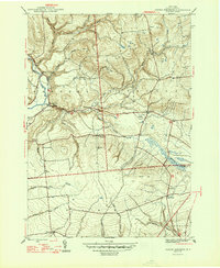
Editions of this 1947 North Western Map
2 editions found
Other maps of this area

1895 · Oriskany
USGS Topo · 1:62,500

1897 · Remsen
USGS Topo · 1:62,500

1898 · Utica
USGS Topo · 1:62,500

1898 · Oriskany
USGS Topo · 1:62,500

1900 · Utica
USGS Topo · 1:62,500

1900 · Remsen
USGS Topo · 1:62,500

1904 · Boonville
USGS Topo · 1:62,500
1945 · South Trenton
USGS Topo · 1:31,680

1945 · Boonville
USGS Topo · 1:24,000

1945 · Forestport
USGS Topo · 1:24,000