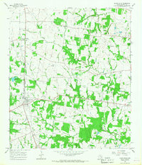
1965 Map of North Zulch
USGS Topo · Published 1967About this map
The intersection of the Chicago Rock Island and Pacific and Fort Worth and Denver railroad and State Highway 21 anchors the community of North Zulch, serving as a central hub for this Madison County landscape during the mid-1960s. The area is defined by a network of rural churches and burial grounds that reflect the long-standing settlement patterns of eastern Texas, including Willow Hole Church, Rock Prairie Church, and Oxford Cemetery.
Find a feature on this map
28 named features on this map. Tap any name to fly to it.
Don’t see what you’re looking for? This feature index may not catch every label — zoom into the map to look around manually.
Map Details
Editions of this 1965 North Zulch Map
2 editions found
Other maps of this area

1925 · Iola No 2
USGS Topo · 1:48,000

1931 · Iola
USGS Topo · 1:62,500

1953 · Palestine
USGS Topo · 1:250,000

1954 · Waco
USGS Topo · 1:250,000

1954 · Beaumont
USGS Topo · 1:250,000

1954 · Austin
USGS Topo · 1:250,000

1955 · Waco
USGS Topo · 1:250,000

1957 · Beaumont
USGS Topo · 1:250,000

1957 · Palestine
USGS Topo · 1:250,000

1959 · Clear Lake
USGS Topo · 1:24,000