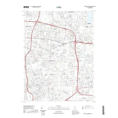
2019 Map of Northeast Columbus
USGS Topo · Published 2019About this map
Alum Creek and Big Walnut Creek define the north-south corridors of this landscape, where early pioneer settlements and modern infrastructure converge. The area transitions from the southern edge of Westerville through suburban pockets like Huber Ridge and Minerva Park, leading down into the dense grid of Columbus and Linden. Genealogical researchers will find significant value in the distribution of historic burial grounds, including the West Pioneer Cem and the McKendree Methodist Episcopal Cem.
Find a feature on this map
52 named features on this map. Tap any name to fly to it.
Don’t see what you’re looking for? This feature index may not catch every label — zoom into the map to look around manually.
Map Details
Editions of this 2019 Northeast Columbus Map
This is the sole edition of this map. No revisions or reprints were ever made.
Other maps of this area

1901 · Dublin
USGS Topo · 1:62,500

1902 · Westerville
USGS Topo · 1:62,500

1903 · Dublin
USGS Topo · 1:62,500

1904 · Westerville
USGS Topo · 1:62,500

1923 · West Columbus
USGS Topo · 1:62,500

1925 · East Columbus
USGS Topo · 1:62,500

1925 · West Columbus
USGS Topo · 1:62,500

1943 · East Columbus
USGS Topo · 1:62,500

1947 · Columbus
USGS Topo · 1:250,000

1950 · Marion
USGS Topo · 1:250,000