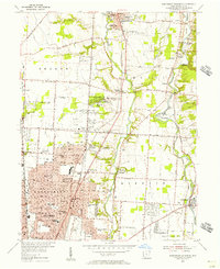
1954 Map of Northeast Columbus
USGS Topo · Published 1956About this map
Otterbein College and the surrounding academic landscape of Westerville dominate the northern portion of this 1954 mid-century survey. The terrain is defined by the parallel courses of Alum Creek and Big Walnut Creek, with the newly completed Hoover Dam and Hoover Reservoir appearing in the northeast corner. This era shows the suburban expansion of Columbus pushing north through Linden and Mifflinville, where residential grids began to replace agricultural fields and golf courses like Minerva Lake Golf Club. Local history and genealogy interest is found in the numerous neighborhood schools and religious sites, such as St James the Less Sch and St Augustine Sch, alongside established rural landmarks like the State Home for the Aged near Central College.
Find a feature on this map
80 named features on this map. Tap any name to fly to it.
Don’t see what you’re looking for? This feature index may not catch every label — zoom into the map to look around manually.
Map Details
Editions of this 1954 Northeast Columbus Map
This is the sole edition of this map. No revisions or reprints were ever made.
Other maps of this area

1901 · Dublin
USGS Topo · 1:62,500

1902 · Westerville
USGS Topo · 1:62,500

1903 · Dublin
USGS Topo · 1:62,500

1904 · Westerville
USGS Topo · 1:62,500

1923 · West Columbus
USGS Topo · 1:62,500

1925 · East Columbus
USGS Topo · 1:62,500

1925 · West Columbus
USGS Topo · 1:62,500

1943 · East Columbus
USGS Topo · 1:62,500

1947 · Columbus
USGS Topo · 1:250,000

1950 · Marion
USGS Topo · 1:250,000