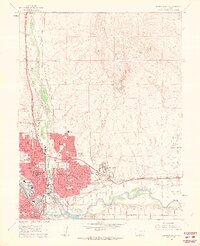
1961 Map of Northeast Pueblo
USGS Topo · Published 1963About this map
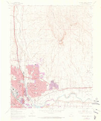
Fountain Creek and the Arkansas River converge at the heart of this early 1960s industrial and residential hub, marking the southeastern expansion of Pueblo. The map reveals a city in transition, where established infrastructure like the Denver and Rio Grande Western Railroad and the Atchison Topeka and Santa Fe lines serve a landscape increasingly defined by mid-century suburban growth. New developments such as Belmont and Fearnowville contrast with older landmarks like Mineral Palace Park and the extensive grounds of the State Hospital. Beyond the urban grid, the terrain rises sharply toward Baculite Mesa, while the Pueblo Memorial Airport occupies the high plains to the east. This survey documents the specific locations of numerous neighborhood schools, including Heaton Jr High Sch and Sommerlid Sch, alongside historic burial sites like the Masonic Cem.
Find a feature on this map
41 named features on this map. Tap any name to fly to it.
Don’t see what you’re looking for? This feature index may not catch every label — zoom into the map to look around manually.
Map Details
Editions of this 1961 Northeast Pueblo Map
7 editions found
Other maps of this area

1891 · Pueblo
USGS Topo · 1:125,000

1891 · Nepesta
USGS Topo · 1:125,000

1893 · Nepesta
USGS Topo · 1:125,000

1894 · Pueblo
USGS Topo · 1:125,000

1896 · Pueblo
USGS Topo · 1:125,000

1897 · Pueblo
USGS Topo · 1:125,000

1904 · Nepesta
USGS Topo · 1:125,000

1954 · Pueblo
USGS Topo · 1:250,000

1957 · Pueblo
USGS Topo · 1:250,000

1958 · Pueblo
USGS Topo · 1:250,000