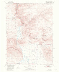
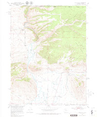
1950 Map of Northgate
USGS Topo · Published 1970About this map
The North Platte River carves a central path through this landscape, marking the rugged transition between the Routt National Forest and the Medicine Bow National Forest at the Colorado-Wyoming border. This 1950 field-checked survey reveals an era of active mining and water management, with the Fluorspar Mine, Camp Creek Mine, and Gero Tunnel Mine dotting the slopes of Pinkham Mountain. The industrial character of the region is further evidenced by the Union Pacific (Newport Branch) railroad, which served the small settlement at Northgate.
Find a feature on this map
33 named features on this map. Tap any name to fly to it.
Don’t see what you’re looking for? This feature index may not catch every label — zoom into the map to look around manually.
Map Details
Editions of this 1950 Northgate Map
6 editions found
Other maps of this area

1906 · Medicine Bow
USGS Topo · 1:125,000

1908 · Medicine Bow
USGS Topo · 1:125,000

1950 · Northgate
USGS Topo · 1:24,000

1950 · Kings Canyon
USGS Topo · 1:24,000

1952 · Northgate
USGS Topo · 1:24,000

1952 · Kings Canyon
USGS Topo · 1:24,000

1954 · Rawlins
USGS Topo · 1:250,000

1954 · Craig
USGS Topo · 1:250,000

1955 · Independence Mountain
USGS Topo · 1:24,000

1955 · Lake John
USGS Topo · 1:24,000