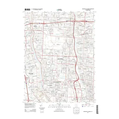
2013 Map of Northwest Columbus
USGS Topo · Published 2013About this map
The Scioto River and Olentangy River corridors define the development of northwestern Franklin County as it appeared in the early 2010s. This survey details the suburban expansion connecting Dublin, Worthington, and Columbus, revealing a landscape where modern infrastructure meets long-established landmarks. The presence of several historic burial grounds, such as Union Cem and Walnut Grove Cem, provides significant genealogical touchpoints within the growing residential zones. Education and specialized institutions are prominent, including the Pontifical Coll Josephinum in the north and the Reflexology Science Institute. The western edge of the map features the Griggs Reservoir and the Ohio State University Airport, illustrating the diverse land use of this region. Smaller incorporated enclaves like Riverlea remain distinct amidst the larger municipalities, while neighborhood names like Eastleft and Seagrave highlight the hyper-local geography of the capital's periphery.
Find a feature on this map
69 named features on this map. Tap any name to fly to it.
Don’t see what you’re looking for? This feature index may not catch every label — zoom into the map to look around manually.
Map Details
Editions of this 2013 Northwest Columbus Map
This is the sole edition of this map. No revisions or reprints were ever made.
Other maps of this area

1901 · Dublin
USGS Topo · 1:62,500

1902 · Westerville
USGS Topo · 1:62,500

1903 · Dublin
USGS Topo · 1:62,500

1904 · Westerville
USGS Topo · 1:62,500

1923 · West Columbus
USGS Topo · 1:62,500

1925 · East Columbus
USGS Topo · 1:62,500

1925 · West Columbus
USGS Topo · 1:62,500

1943 · East Columbus
USGS Topo · 1:62,500

1947 · Columbus
USGS Topo · 1:250,000

1950 · Marion
USGS Topo · 1:250,000