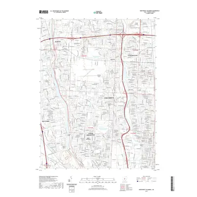
2019 Map of Northwest Columbus
USGS Topo · Published 2019About this map
Columbus and its northern suburbs are defined by the corridors of the Olentangy River and the Scioto River in this detailed 2019 survey. The landscape reflects a dense suburban network established across the townships of Franklin County, where older settlements like Linworth and the village of Riverlea are surrounded by modern residential expansion. For genealogists, the map is particularly useful for identifying family burial sites, including the large Union Cem and smaller local landmarks such as Davis Cem and the Roads and Wesley Chapel Cem.
Find a feature on this map
83 named features on this map. Tap any name to fly to it.
Don’t see what you’re looking for? This feature index may not catch every label — zoom into the map to look around manually.
Map Details
Editions of this 2019 Northwest Columbus Map
This is the sole edition of this map. No revisions or reprints were ever made.
Other maps of this area

1901 · Dublin
USGS Topo · 1:62,500

1902 · Westerville
USGS Topo · 1:62,500

1903 · Dublin
USGS Topo · 1:62,500

1904 · Westerville
USGS Topo · 1:62,500

1923 · West Columbus
USGS Topo · 1:62,500

1925 · East Columbus
USGS Topo · 1:62,500

1925 · West Columbus
USGS Topo · 1:62,500

1943 · East Columbus
USGS Topo · 1:62,500

1947 · Columbus
USGS Topo · 1:250,000

1950 · Marion
USGS Topo · 1:250,000