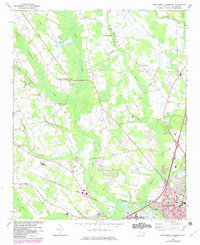
1972 Map of Northwest Lumberton
USGS Topo · Published 1983About this map
The Raft Swamp drainage system dominates this Robeson County landscape, carving a broad swath of wetlands through a region defined by agricultural plots and scattered rural settlements. These small communities, including Saddletree and Clybonville, are anchored by a high density of country churches such as Mt Olive Ch, Mt Zion Ch, and Evergreen Ch. Educational sites like the Magnolia High Sch and Piney Grove Sch provide focal points for local genealogy, while family-named landmarks like Mc Niell Cem and Maynor Cem offer specific data for historical research.
Find a feature on this map
59 named features on this map. Tap any name to fly to it.
Don’t see what you’re looking for? This feature index may not catch every label — zoom into the map to look around manually.
Map Details
Editions of this 1972 Northwest Lumberton Map
2 editions found
Other maps of this area

1953 · Florence
USGS Topo · 1:250,000

1954 · Florence
USGS Topo · 1:250,000

1957 · Bladenboro
USGS Topo · 1:62,500

1959 · Saint Pauls
USGS Topo · 1:62,500

1972 · Northwest Lumberton
USGS Topo · 1:24,000

1972 · Southwest Lumberton
USGS Topo · 1:24,000

1972 · Rennert
USGS Topo · 1:24,000

1972 · Pembroke
USGS Topo · 1:24,000
1972 · Mc Donald
USGS Topo · 1:24,000
1974 · Red Springs
USGS Topo · 1:24,000