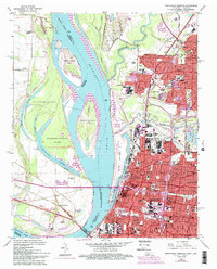
1965 Map of Northwest Memphis
USGS Topo · Published 1993About this map
The Mississippi River and its dynamic alluvial landscape dominate this mid-century view of the riverfront, where the Loosahatchie River and Wolf River converge near the city center. The terrain is marked by shifting bars and islands, including Robinson Crusoe Island and the substantial Mud Island sheltering the Lagoon. The map documents a dense urban fabric extending from the riverbanks through the neighborhoods of Frayser and north Memphis, showing a robust network of educational and religious institutions such as Owen College, Humes Sch, and Our Lady of Sorrows Sch.
Find a feature on this map
76 named features on this map. Tap any name to fly to it.
Don’t see what you’re looking for? This feature index may not catch every label — zoom into the map to look around manually.
Map Details
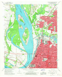
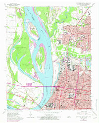
Editions of this 1965 Northwest Memphis Map
3 editions found
Other maps of this area

1916 · Memphis
USGS Topo · 1:62,500

1925 · Memphis
USGS Topo · 1:48,000

1927 · Memphis
USGS Topo · 1:62,500

1931 · Jericho
USGS Topo · 1:62,500

1939 · Jericho
USGS Topo · 1:62,500

1939 · Memphis
USGS Topo · 1:62,500

1942 · Millington
USGS Topo · 1:62,500

1952 · Jericho
USGS Topo · 1:62,500

1953 · Memphis
USGS Topo · 1:250,000

1955 · Memphis
USGS Topo · 1:62,500