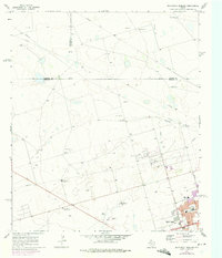
1966 Map of Northwest Midland
USGS Topo · Published 1975About this map
The expanding northern limits of Midland take center stage in this mid-1960s survey, showing a landscape defined by the intersection of ranching heritage and the rising petroleum industry. Urban development is clustered in the southeast corner, where neighborhoods reach outward past the Lee High Sch and Rusk Sch. A local cultural landmark, the Drive-in Theater, sits at the southern edge near Andrews Highway, while the educational landscape is marked by the Episcopal Day Sch.
Find a feature on this map
27 named features on this map. Tap any name to fly to it.
Don’t see what you’re looking for? This feature index may not catch every label — zoom into the map to look around manually.
Map Details
Editions of this 1966 Northwest Midland Map
3 editions found

Other maps of this area

1954 · Hobbs
USGS Topo · 1:250,000

1954 · Pecos
USGS Topo · 1:250,000

1957 · Pecos
USGS Topo · 1:250,000

1958 · Hobbs
USGS Topo · 1:250,000

1964 · Odessa NE
USGS Topo · 1:24,000

1965 · Southeast Midland
USGS Topo · 1:24,000

1965 · Southwest Midland
USGS Topo · 1:24,000

1965 · Northeast Midland
USGS Topo · 1:24,000

1966 · Mabee Ranch
USGS Topo · 1:24,000

1966 · North Curtis Ranch
USGS Topo · 1:24,000