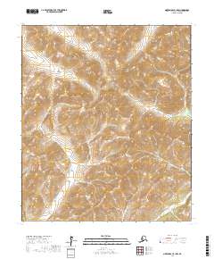
2017 Map of Norton Bay B-1 NW
USGS Topo · Published 2017About this map
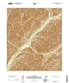
N Fork Unalakleet River defines the western drainage of this interior landscape within the Yukon-Koyukuk Census Area. This 2017 survey reveals a remote terrain shaped by high ridgelines and descending river valleys, where the N Fork Unalakleet River cuts through the southwestern corner. To the north and east, the headwaters of Kalasik Cr and the S Fork Nulato River trace the divergent flow of water across the continental divide of the Seward Peninsula’s base. The absence of roads or established settlements emphasizes the wilderness character of the region, which is meticulously gridded by the Public Land Survey System including t12s r4w and t12s r3w. For researchers, the map provides precise contour data and hydrographic patterns essential for understanding the traditional subsistence corridors and land boundaries in this part of Alaska.
Find a feature on this map
9 named features on this map. Tap any name to fly to it.
Don’t see what you’re looking for? This feature index may not catch every label — zoom into the map to look around manually.
Map Details
Editions of this 2017 Norton Bay B-1 NW Map
This is the sole edition of this map. No revisions or reprints were ever made.
Other maps of this area

1948 · Norton Bay
USGS Topo · 1:250,000

1951 · Norton Bay
USGS Topo · 1:250,000

1952 · Norton Bay B-1
USGS Topo · 1:63,360
1952 · Norton Bay C-1
USGS Topo · 1:63,360
1953 · Norton Bay B-2
USGS Topo · 1:63,360

1953 · Norton Bay C-2
USGS Topo · 1:63,360

1955 · Norton Bay
USGS Topo · 1:250,000
2014 · Norton Bay B-1 SE
USGS Topo · 1:25,000
2017 · Norton Bay B-2 SE
USGS Topo · 1:25,000
2017 · Norton Bay B-1 NE
USGS Topo · 1:25,000