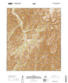
2017 Map of Norton Bay B-3 SW
USGS Topo · Published 2017About this map
Nulato Hills define the high elevation and complex drainage patterns of this remote interior Alaska landscape within the Nome Census Area. The terrain is characterized by a series of steep ridges and deep valleys carved by seasonal waterways. The hydrological network is led by Anakeksik Cr, which flows southward through the center of the sheet, joined by smaller systems including Kingmetolik Cr in the northeast and Equivik Cr to the south. This 2017 survey reflects a wilderness largely devoid of human infrastructure, focusing instead on the natural topography and the township boundaries of T13S R9W, T13S R8W, T14S R9W, and T14S R8W. The lack of roads or established settlements emphasizes the undisturbed character of this subarctic environment, offering a clear view of the natural watercourses that define local movement through the hills.
Find a feature on this map
8 named features on this map. Tap any name to fly to it.
Don’t see what you’re looking for? This feature index may not catch every label — zoom into the map to look around manually.
Map Details
Editions of this 2017 Norton Bay B-3 SW Map
This is the sole edition of this map. No revisions or reprints were ever made.
Other maps of this area

1948 · Norton Bay
USGS Topo · 1:250,000

1950 · Norton Bay B-4
USGS Topo · 1:63,360

1950 · Norton Bay B-3
USGS Topo · 1:63,360

1950 · Norton Bay A-4
USGS Topo · 1:63,360

1950 · Norton Bay A-3
USGS Topo · 1:63,360

1951 · Norton Bay
USGS Topo · 1:250,000

1955 · Norton Bay
USGS Topo · 1:250,000
2017 · Norton Bay A-3 NE
USGS Topo · 1:25,000
2017 · Norton Bay B-4 SE
USGS Topo · 1:25,000
2017 · Norton Bay B-3 NW
USGS Topo · 1:25,000