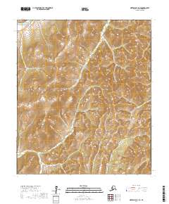
2017 Map of Norton Bay B-4 SE
USGS Topo · Published 2017About this map
The Nulato Hills dominate this portion of the Nome Census Area, presenting a landscape of high ridges and deep drainage basins. In the northwest corner, the Shaktoolik River cuts through the terrain, while the central portion of the map is defined by the headwaters of Buck Cr. This 2017 survey reflects a largely uninhabited interior, illustrating the topographical isolation of the region before it meets the coastal plains. The land is organized by the Public Land Survey System, with township and range lines such as t13s r10w and t14s r10w providing the only human-imposed structure on the complex elevation contours of the hills.
Find a feature on this map
9 named features on this map. Tap any name to fly to it.
Don’t see what you’re looking for? This feature index may not catch every label — zoom into the map to look around manually.
Map Details
Editions of this 2017 Norton Bay B-4 SE Map
This is the sole edition of this map. No revisions or reprints were ever made.
Other maps of this area

1948 · Norton Bay
USGS Topo · 1:250,000

1950 · Norton Bay B-4
USGS Topo · 1:63,360

1950 · Norton Bay B-3
USGS Topo · 1:63,360

1950 · Norton Bay A-4
USGS Topo · 1:63,360

1950 · Norton Bay A-3
USGS Topo · 1:63,360

1951 · Norton Bay
USGS Topo · 1:250,000

1955 · Norton Bay
USGS Topo · 1:250,000
2014 · Norton Bay B-4 SW
USGS Topo · 1:25,000
2014 · Norton Bay A-4 NW
USGS Topo · 1:25,000
2014 · Norton Bay B-4 NW
USGS Topo · 1:25,000