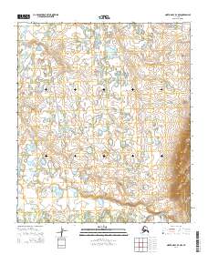
2014 Map of Norton Bay B-4 NW
USGS Topo · Published 2014About this map
Shaktoolik River drainage dominates this section of the Seward Peninsula, where a network of tundra waterways defines the landscape north of Norton Bay. This 2014 survey captures a remote coastal interior characterized by the meandering paths of First Cr, Second Cr, and Third Cr. These tributaries carve through the low-lying terrain, creating a complex system of ponds and wetlands typical of this subarctic environment. The map provides a precise layout of the Public Land Survey System grid, including boundaries for t12s r11w and t13s r11w, which are essential for identifying specific land tracts in this expansive wilderness. The presence of the sha2014 trail or route label suggests modern transit corridors through an otherwise trackless expanse, offering a rare point of reference for navigating the native lands of western Alaska.
Find a feature on this map
13 named features on this map. Tap any name to fly to it.
Don’t see what you’re looking for? This feature index may not catch every label — zoom into the map to look around manually.
Map Details
Editions of this 2014 Norton Bay B-4 NW Map
This is the sole edition of this map. No revisions or reprints were ever made.
Other maps of this area

1948 · Norton Bay
USGS Topo · 1:250,000

1950 · Norton Bay B-5
USGS Topo · 1:63,360

1950 · Norton Bay B-4
USGS Topo · 1:63,360

1950 · Norton Bay C-5
USGS Topo · 1:63,360

1950 · Norton Bay C-4
USGS Topo · 1:63,360

1951 · Norton Bay
USGS Topo · 1:250,000

1955 · Norton Bay
USGS Topo · 1:250,000
2014 · Norton Bay B-5 SE
USGS Topo · 1:25,000
2014 · Norton Bay B-5 NE
USGS Topo · 1:25,000
2014 · Norton Bay B-4 SW
USGS Topo · 1:25,000