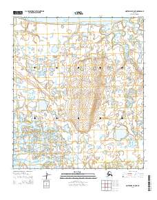
2014 Map of Norton Bay B-5 NE
USGS Topo · Published 2014About this map
Norton Sound defines the western reaches of this coastal landscape, where the cold waters of the Bering Sea meet a complex network of wetlands and tidal inlets. The shoreline is punctuated by Reindeer Cove to the north and the expansive Shaktoolik Bay at the southern end, reflecting the maritime character of this subarctic region. Inland, the terrain is a saturated mosaic of ponds and small lakes drained by watercourses such as Second Cr and Third Cr. This 2014 survey documents a wilderness largely defined by its natural drainage patterns and coastal features, with few man-made landmarks beyond the township and range lines and localized tracking labels such as sha2004. It serves as a clear record of the hydrologic state of this remote Alaskan coastline before further environmental shifts.
Find a feature on this map
15 named features on this map. Tap any name to fly to it.
Don’t see what you’re looking for? This feature index may not catch every label — zoom into the map to look around manually.
Map Details
Editions of this 2014 Norton Bay B-5 NE Map
This is the sole edition of this map. No revisions or reprints were ever made.
Other maps of this area

1948 · Norton Bay
USGS Topo · 1:250,000

1950 · Norton Bay B-5
USGS Topo · 1:63,360

1950 · Norton Bay B-4
USGS Topo · 1:63,360

1950 · Norton Bay C-5
USGS Topo · 1:63,360

1950 · Norton Bay C-4
USGS Topo · 1:63,360

1951 · Norton Bay
USGS Topo · 1:250,000

1955 · Norton Bay
USGS Topo · 1:250,000
2014 · Norton Bay B-5 SE
USGS Topo · 1:25,000
2014 · Norton Bay B-5 NW
USGS Topo · 1:25,000
2014 · Norton Bay C-5 SW
USGS Topo · 1:25,000