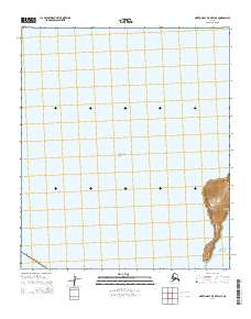
2014 Map of Norton Bay B-5 OE W NE
USGS Topo · Published 2014About this map
Cape Denbigh anchors the southeastern corner of this maritime-focused survey, where the rugged landform of the Reindeer Hills rises sharply from the water's edge. This coastal section of the Nome Census Area is defined by the meeting of three major bodies of water: the sheltered Norton Bay, the open expanse of the Bering Sea, and the northern reaches of Norton Sound. The landscape is largely aquatic, with the map providing a detailed study of the shoreline transition and the bathymetric character of these remote Alaskan waters. Beyond the isolated elevations of the hills, the sheet consists primarily of open sea, illustrating the vast distances and maritime routes that characterize this portion of the Seward Peninsula's southern coast.
Find a feature on this map
10 named features on this map. Tap any name to fly to it.
Don’t see what you’re looking for? This feature index may not catch every label — zoom into the map to look around manually.
Map Details
Editions of this 2014 Norton Bay B-5 OE W NE Map
This is the sole edition of this map. No revisions or reprints were ever made.
Other maps of this area

1948 · Norton Bay
USGS Topo · 1:250,000

1950 · Norton Bay B-5
USGS Topo · 1:63,360

1950 · Norton Bay C-6
USGS Topo · 1:63,360

1950 · Norton Bay C-5
USGS Topo · 1:63,360

1951 · Norton Bay
USGS Topo · 1:250,000

1955 · Norton Bay
USGS Topo · 1:250,000
2014 · Norton Bay B-5 NW
USGS Topo · 1:25,000
2014 · Norton Bay C-5 SW
USGS Topo · 1:25,000