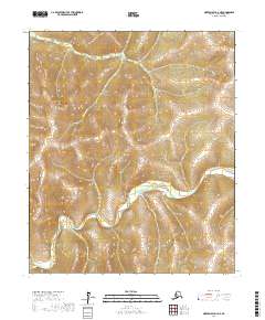
2017 Map of Norton Bay D-3 NE
USGS Topo · Published 2017About this map
The Ungalik River winds through this interior portion of the Nome Census Area, carving a distinct path through the topography of the Seward Peninsula. This 2017 survey captures a remote Alaskan landscape defined by its drainage systems rather than human settlements or infrastructure. In the northern reaches, Little Bear Creek serves as a primary tributary, feeding into the broader watershed. The map detail focuses on the natural contours and the relationship between these watercourses and the surrounding high ground within the boundaries of t6s r7w, t6s r8w, t7s r7w, and t7s r8w. For those studying the hydrology of the Norton Bay region, these labels provide precise reference points for navigating the drainage patterns and elevation changes of the Unalakleet area's backcountry.
Find a feature on this map
6 named features on this map. Tap any name to fly to it.
Don’t see what you’re looking for? This feature index may not catch every label — zoom into the map to look around manually.
Map Details
Editions of this 2017 Norton Bay D-3 NE Map
This is the sole edition of this map. No revisions or reprints were ever made.
Other maps of this area

1948 · Norton Bay
USGS Topo · 1:250,000

1950 · Norton Bay D-3
USGS Topo · 1:63,360

1951 · Candle
USGS Topo · 1:250,000

1951 · Norton Bay
USGS Topo · 1:250,000

1954 · Candle A-2
USGS Topo · 1:63,360

1954 · Norton Bay D-2
USGS Topo · 1:63,360

1955 · Candle
USGS Topo · 1:250,000

1955 · Norton Bay
USGS Topo · 1:250,000

1955 · Candle A-2
USGS Topo · 1:63,360

1964 · Candle
USGS Topo · 1:250,000