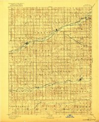
1893 Map of Norton
USGS Topo · Published 1922About this map
Norton serves as the central hub of this late 19th-century landscape, positioned where the high plains begin to roll into the river valleys of Northwest Kansas. The region is defined by two parallel eastward-flowing drainage systems: Prairie Dog Creek in the north and the North Fork Solomon River in the south. These waterways dictated the placement of early settlements and the subsequent expansion of the rail network. The Chicago Rock Island and Pacific Railroad and the Burlington and Missouri River Railroad follow the contours of the creek beds, connecting towns like Almena, Prairie View, and Long Island. Further south, the Pacific Railroad tracks the Solomon River, providing vital transit for Lenora, Densmore, and Logan. The map reveals a highly structured township system, with boundaries such as Almena and Center reflecting the systematic organization of the frontier during this era of agricultural development.
Find a feature on this map
45 named features on this map. Tap any name to fly to it.
Don’t see what you’re looking for? This feature index may not catch every label — zoom into the map to look around manually.
Map Details
Editions of this 1893 Norton Map
4 editions found
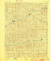
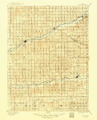
Other maps of this area

1893 · Norton
USGS Topo · 1:125,000

1893 · Phillipsburg
USGS Topo · 1:125,000

1893 · Hill
USGS Topo · 1:125,000

1896 · Holdrege
USGS Topo · 1:125,000

1896 · Arapahoe
USGS Topo · 1:125,000

1896 · Plainville
USGS Topo · 1:125,000

1898 · Arapahoe
USGS Topo · 1:125,000

1951 · Norton
USGS Topo · 1:62,500

1951 · Norcatur
USGS Topo · 1:62,500

1952 · Webster Dam
USGS Topo · 1:24,000