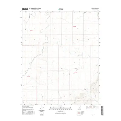
2017 Map of Norton
USGS Topo · Published 2017About this map
Norton sits at the northern edge of this high plains landscape in Quay County, where the grid of the Public Land Survey System meets the dramatic topography of the Llano Estacado. The terrain is defined by the striking escarpment of The Caprock in the southeast, which drops away toward Puerto Canyon. The hydrology of the area is shaped by several drainages, including Barranca Cr, Puerto Cr, and Dog Canyon Cr, which cut through the level mesas. This 2017 survey shows a sparsely settled ranching landscape interconnected by a network of local roads such as Quay Road 51 and Quay Road AD. For local historians, the Puerto Cem serves as a significant marker of the community's heritage in the southern portion of the quadrangle, located near the head of the canyon system.
Find a feature on this map
14 named features on this map. Tap any name to fly to it.
Don’t see what you’re looking for? This feature index may not catch every label — zoom into the map to look around manually.
Map Details
Editions of this 2017 Norton Map
This is the sole edition of this map. No revisions or reprints were ever made.
Other maps of this area

1930 · Tucumcari
USGS Topo · 1:125,000

1954 · Tucumcari
USGS Topo · 1:250,000

1954 · Clovis
USGS Topo · 1:250,000

1958 · Clovis
USGS Topo · 1:250,000

1958 · Tucumcari
USGS Topo · 1:250,000

1968 · Bulldog Mesa
USGS Topo · 1:24,000

1968 · Bedford Hill
USGS Topo · 1:24,000
1968 · Tucumcari SE
USGS Topo · 1:24,000

1971 · Ragland
USGS Topo · 1:24,000
1971 · Mesa Redonda
USGS Topo · 1:24,000