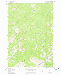
1962 Map of Norton Ridge
USGS Topo · Published 1983About this map
Norton Ridge dominates this 1962 landscape, a high-elevation backcountry where the Boise National Forest meets the Challis National Forest. This survey captures a region defined by isolation and topography, with the Norton Ridge Lookout and the Mahoney Creek Lookout Heliport serving as critical fire-management nodes in a wilderness that lacked road access. The presence of the Mitchell Ranch along Marble Creek indicates one of the few permanent human footprints in this drainage-heavy terrain.
Find a feature on this map
28 named features on this map. Tap any name to fly to it.
Don’t see what you’re looking for? This feature index may not catch every label — zoom into the map to look around manually.
Map Details
Editions of this 1962 Norton Ridge Map
3 editions found
Other maps of this area

1930 · Casto
USGS Topo · 1:125,000

1957 · Challis
USGS Topo · 1:250,000

1960 · Challis
USGS Topo · 1:250,000

1961 · Greyhound Ridge
USGS Topo · 1:62,500

1962 · Bear Creek Point
USGS Topo · 1:24,000

1962 · Norton Ridge
USGS Topo · 1:24,000

1962 · Shellrock Peak
USGS Topo · 1:24,000

1962 · Ramey Hill
USGS Topo · 1:24,000

1963 · Challis
USGS Topo · 1:250,000
1963 · Sliderock Ridge
USGS Topo · 1:24,000