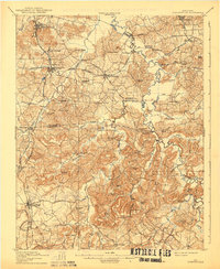
1912 Map of Nortonville
USGS Topo · Published 1939About this map
Pond River and its labyrinthine swampy lowlands carve a clear boundary between Hopkins, Muhlenberg, and Christian counties in this pre-World War I survey. The landscape is defined by a dense network of early 20th-century rural infrastructure, where the Louisville and Nashville RR and the Illinois Central RR intersect at Nortonville. This junction served as a vital hub for the region's movement of goods and people.
Find a feature on this map
83 named features on this map. Tap any name to fly to it.
Don’t see what you’re looking for? This feature index may not catch every label — zoom into the map to look around manually.
Map Details
Editions of this 1912 Nortonville Map
3 editions found
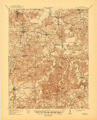
Other maps of this area

1907 · Earlington
USGS Topo · 1:48,000

1909 · Dawson Springs
USGS Topo · 1:48,000

1909 · Earlington
USGS Topo · 1:62,500

1909 · Madisonville
USGS Topo · 1:62,500

1909 · Central City
USGS Topo · 1:62,500

1911 · Dawson Springs
USGS Topo · 1:62,500

1911 · Drakesboro
USGS Topo · 1:48,000

1912 · Nortonville
USGS Topo · 1:62,500

1913 · Drakesboro
USGS Topo · 1:62,500

1952 · Pleasant Green Hill
USGS Topo · 1:24,000