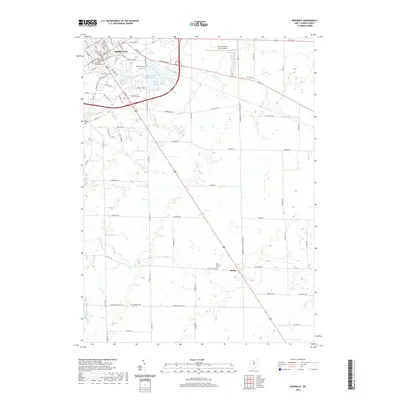
2019 Map of Norwalk
USGS Topo · Published 2019About this map
The Huron County Courthouse stands as the central landmark of Norwalk, anchoring a city plan characterized by established residential avenues like Woodlawn Ave and Benedict Ave. The area’s historical depth is evident through its numerous burial grounds, including the Woodlawn Cem, Saint Peter Catholic Cem, and the interestingly named Axe Factory Cem. To the southeast, the small settlement of Olena marks the rural landscape, while Memorial Reservoir and Norwalk Cr provide significant hydrological features. The transition from the urban density of the city to the surrounding agricultural land is punctuated by modern developments like Fisher-Titus and the Norwalk-Huron County Airport, reflecting the ongoing growth within Huron County. This landscape reveals a balance between preserved civic heritage and contemporary infrastructure.
Find a feature on this map
83 named features on this map. Tap any name to fly to it.
Don’t see what you’re looking for? This feature index may not catch every label — zoom into the map to look around manually.
Map Details
Editions of this 2019 Norwalk Map
This is the sole edition of this map. No revisions or reprints were ever made.
Other maps of this area

1903 · Vermilion
USGS Topo · 1:62,500

1904 · Sandusky
USGS Topo · 1:62,500

1908 · New London
USGS Topo · 1:62,500

1915 · Norwalk
USGS Topo · 1:62,500

1944 · Norwalk
USGS Topo · 1:62,500

1956 · Toledo
USGS Topo · 1:250,000

1959 · Kimball
USGS Topo · 1:24,000

1959 · Milan
USGS Topo · 1:24,000

1959 · Berlin Heights
USGS Topo · 1:24,000

1960 · New London
USGS Topo · 1:24,000