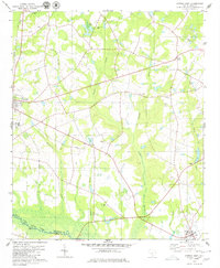
1979 Map of Norway East
USGS Topo · Published 1979About this map
Roberts Swamp and its many tributaries, including Deadfall Branch and Twomile Swamp, dominate the low-lying terrain of this late 1970s landscape in Orangeburg County. The area's social fabric is visible through a high density of rural religious and educational centers, from Heritage Hill Academy in the northwest to Cope in the southeast. Numerous community focal points like Lebanon Ch, Bethany Ch, and Mt Zion Ch are scattered across the quadrangle, serving local families near settlements such as Wilson and Bolen Town.
Find a feature on this map
31 named features on this map. Tap any name to fly to it.
Don’t see what you’re looking for? This feature index may not catch every label — zoom into the map to look around manually.
Map Details
Editions of this 1979 Norway East Map
2 editions found
Other maps of this area

1919 · Bamberg
USGS Topo · 1:48,000

1920 · Bamberg
USGS Topo · 1:62,500

1920 · Orangeburg
USGS Topo · 1:48,000

1921 · Orangeburg
USGS Topo · 1:62,500

1943 · Bamberg
USGS Topo · 1:62,500

1943 · Orangeburg
USGS Topo · 1:125,000

1943 · Orangeburg
USGS Topo · 1:62,500

1946 · Woodford
USGS Topo · 1:62,500

1946 · St. Matthews
USGS Topo · 1:62,500

1954 · Augusta
USGS Topo · 1:250,000