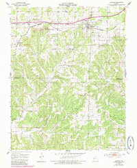
1951 Map of Norwood
USGS Topo · Published 1985About this map
The Burlington Northern railroad corridor anchors this mid-century portrait of southern Wright and northern Douglas counties. The town of Norwood serves as the primary hub along the rail line, while the smaller settlement of Macomb sits to the west, each surrounded by a network of rural schools and churches that defined Ozark social life in the 1950s. The landscape transition is evident at the Blue Slip State Wildlife Management Area, where the terrain begins to drop into the drainage basins of the South Fork and Fox Creek.
Find a feature on this map
37 named features on this map. Tap any name to fly to it.
Don’t see what you’re looking for? This feature index may not catch every label — zoom into the map to look around manually.
Map Details
Editions of this 1951 Norwood Map
2 editions found
Other maps of this area

1936 · Ava
USGS Topo · 1:48,000

1937 · Buckhart
USGS Topo · 1:48,000

1942 · Ava
USGS Topo · 1:62,500

1943 · Buckhart
USGS Topo · 1:62,500

1945 · Ava
USGS Topo · 1:62,500

1945 · Harrison
USGS Topo · 1:250,000

1945 · Buckhart
USGS Topo · 1:62,500

1949 · Harrison
USGS Topo · 1:250,000

1951 · Norwood
USGS Topo · 1:24,000

1951 · Mountain Grove South
USGS Topo · 1:24,000