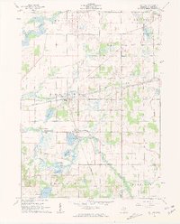
1961 Map of Nottawa
USGS Topo · Published 1962About this map
Wasepi and Nottawa anchor this rural landscape in St. Joseph County, where the transportation networks of the early 1960s are clearly defined. The area is characterized by a significant water system, featuring a chain of lakes including Sand Lake, Sylvan Lake, Evans Lake, and Sauger Lake, all interconnected by the Prairie River. The map reveals a transition in rail dominance, showing the Pennsylvania railroad and the New York Central lines crossing near the heart of the township, supporting local gravel and sand extraction industries. Numerous family and community landmarks are preserved here, from the Laird Cem and Pioneer Cem to the Locust Grove Ch, providing a detailed look at the social fabric of the Michigan countryside before modern development altered the density of these small settlements.
Find a feature on this map
36 named features on this map. Tap any name to fly to it.
Don’t see what you’re looking for? This feature index may not catch every label — zoom into the map to look around manually.
Map Details
Editions of this 1961 Nottawa Map
3 editions found
Other maps of this area

1914 · Three Rivers
USGS Topo · 1:62,500

1916 · Three Rivers
USGS Topo · 1:62,500

1918 · Leonidas
USGS Topo · 1:62,500

1922 · Schoolcraft
USGS Topo · 1:62,500

1943 · Three Rivers
USGS Topo · 1:62,500

1943 · Schoolcraft
USGS Topo · 1:62,500

1944 · Leonidas
USGS Topo · 1:62,500

1947 · Leonidas
USGS Topo · 1:62,500

1950 · Leonidas
USGS Topo · 1:62,500

1953 · Fort Wayne
USGS Topo · 1:250,000