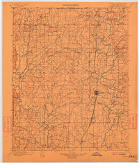
1901 Map of Nowata
USGS Topo · Published 1911About this map
Nowata serves as the central hub of this Cherokee Nation survey, which captures the region at a time when the Indian Territory Kansas Boundary Line and the Indian Territory Oklahoma Boundary Line still defined the political landscape. The development of the area is closely tied to the expansion of rail lines, with the Atchison Topeka and Santa Fe R. R. and the St. Louis Iron Mountain and Southern R. R. cutting through the territory. These rail corridors fostered the growth of towns like Bartlesville, Delaware, and Lenapah.
Find a feature on this map
60 named features on this map. Tap any name to fly to it.
Don’t see what you’re looking for? This feature index may not catch every label — zoom into the map to look around manually.
Map Details
Editions of this 1901 Nowata Map
2 editions found
Other maps of this area

1885 · Sedan
USGS Topo · 1:125,000

1886 · Independence
USGS Topo · 1:125,000

1886 · Parsons
USGS Topo · 1:125,000

1889 · Sedan
USGS Topo · 1:125,000

1893 · Parsons
USGS Topo · 1:125,000

1894 · Independence
USGS Topo · 1:125,000

1896 · Pryor
USGS Topo · 1:125,000

1901 · Claremore
USGS Topo · 1:125,000

1901 · Nowata
USGS Topo · 1:125,000

1901 · Vinita
USGS Topo · 1:125,000