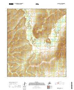
2019 Map of Nulato A-2 NW
USGS Topo · Published 2019About this map
Yuki River meanders through this interior Alaska landscape, defining the local drainage patterns across several townships in the Yukon-Koyukuk region. The watercourse follows a winding path through the center of the sheet, joined in the southeast by the E Fork Yuki River and in the north by Kaltkede Cr. The terrain is characterized by intricate contour lines that reveal the elevation changes common to this subarctic wilderness, where the absence of roads and established settlements underscores the isolation of the area. This 2019 data represents a contemporary understanding of the hydrography and topography within the Nulato A-2 NW quadrangle, providing a technical record of the land as it exists in the early twenty-first century.
Find a feature on this map
12 named features on this map. Tap any name to fly to it.
Don’t see what you’re looking for? This feature index may not catch every label — zoom into the map to look around manually.
Map Details
Editions of this 2019 Nulato A-2 NW Map
This is the sole edition of this map. No revisions or reprints were ever made.
Other maps of this area

1945 · Nulato
USGS Topo · 1:250,000

1951 · Nulato
USGS Topo · 1:250,000

1952 · Nulato B-2
USGS Topo · 1:63,360

1952 · Nulato A-2
USGS Topo · 1:63,360

1952 · Nulato B-3
USGS Topo · 1:63,360

1952 · Nulato A-3
USGS Topo · 1:63,360

1952 · Nulato
USGS Topo · 1:250,000

1964 · Nulato
USGS Topo · 1:250,000
2017 · Nulato B-3 SE
USGS Topo · 1:25,000
2017 · Nulato A-3 NE
USGS Topo · 1:25,000