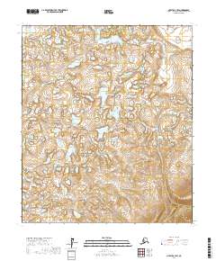
2017 Map of Nulato C-3 SW
USGS Topo · Published 2017About this map
The interior wilderness of the T10s R7e and T10s R8e townships is defined by an intricate network of wetlands and small kettle lakes. This 2017 survey by the U.S. Geological Survey reveals a landscape shaped by glacial topography within the Yukon-Koyukuk Census Area, largely devoid of human infrastructure or permanent settlements. The high-resolution elevation data tracks the subtle rise and fall of the terrain across the southern T11s R7e and T11s R8e sections, where the drainage patterns suggest a complex hydrologic environment. Researchers and geologists can use these contour lines to identify distinct landforms in this remote region of Alaska, where natural processes remain the primary architects of the land.
Find a feature on this map
4 named features on this map. Tap any name to fly to it.
Don’t see what you’re looking for? This feature index may not catch every label — zoom into the map to look around manually.
Map Details
Editions of this 2017 Nulato C-3 SW Map
This is the sole edition of this map. No revisions or reprints were ever made.
Other maps of this area

1945 · Nulato
USGS Topo · 1:250,000

1951 · Nulato
USGS Topo · 1:250,000

1952 · Nulato C-3
USGS Topo · 1:63,360

1952 · Nulato C-4
USGS Topo · 1:63,360

1952 · Nulato B-3
USGS Topo · 1:63,360

1952 · Nulato B-4
USGS Topo · 1:63,360

1952 · Nulato
USGS Topo · 1:250,000
1953 · Nulato C-4
USGS Topo · 1:63,360

1964 · Nulato
USGS Topo · 1:250,000
2017 · Nulato C-4 NE
USGS Topo · 1:25,000