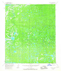
1953 Map of Nulato C-4
USGS Topo · Published 1967About this map
Soonkakat River winds through a vast, water-heavy landscape in this 1950s survey of the Alaska interior. The terrain is defined by a dense network of small ponds and wetlands, illustrating the complex hydrology of the region before modern development. In the northwest corner, the drainage pattern becomes more pronounced where Patsy Slough and Happy Slough flank Big Island. These waterways are characteristic of the meandering river systems that dictate travel and seasonal change in the Yukon-Koyukuk region. Compiled from aerial photography taken in 1952, the map documents a remote wilderness largely untouched by infrastructure, showing the natural state of the land as it was managed by the Bureau of Land Management during the mid-century era.
Find a feature on this map
5 named features on this map. Tap any name to fly to it.
Don’t see what you’re looking for? This feature index may not catch every label — zoom into the map to look around manually.
Map Details
Editions of this 1953 Nulato C-4 Map
2 editions found
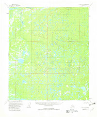
Other maps of this area

1945 · Nulato
USGS Topo · 1:250,000

1951 · Nulato
USGS Topo · 1:250,000

1952 · Nulato D-3
USGS Topo · 1:63,360

1952 · Nulato D-5
USGS Topo · 1:63,360

1952 · Nulato C-3
USGS Topo · 1:63,360

1952 · Nulato C-4
USGS Topo · 1:63,360

1952 · Nulato B-5
USGS Topo · 1:63,360

1952 · Nulato D-4
USGS Topo · 1:63,360

1952 · Nulato B-3
USGS Topo · 1:63,360

1952 · Nulato B-4
USGS Topo · 1:63,360