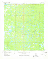
1953 Map of Nulato C-4
USGS Topo · Published 1982About this map
Soonkakat River meanders across this interior Alaskan landscape, defining a complex hydrologic network of wetlands and seasonal waterways as they appeared in the early 1950s. The northern edge of the map is dominated by the broad, braided channels of Patsy Slough and Happy Slough, which isolate the landmass of Big Island. This region, surveyed via photogrammetric methods from 1952 aerial photography, remains largely untouched by permanent settlements or roads, instead characterized by the intricate drainage of Gorton Creek and numerous unnamed lakes and marshes. The presence of predetermined, unsurveyed land lines from the Bureau of Land Management illustrates the early stages of formalizing land tenure in this remote portion of the Yukon-Koyukuk region, where the terrain itself dictated the movement of indigenous peoples and early explorers along its river corridors.
Find a feature on this map
8 named features on this map. Tap any name to fly to it.
Don’t see what you’re looking for? This feature index may not catch every label — zoom into the map to look around manually.
Map Details
Editions of this 1953 Nulato C-4 Map
2 editions found
Other maps of this area

1945 · Nulato
USGS Topo · 1:250,000

1951 · Nulato
USGS Topo · 1:250,000

1952 · Nulato D-3
USGS Topo · 1:63,360

1952 · Nulato D-5
USGS Topo · 1:63,360

1952 · Nulato C-3
USGS Topo · 1:63,360

1952 · Nulato C-4
USGS Topo · 1:63,360

1952 · Nulato B-5
USGS Topo · 1:63,360

1952 · Nulato D-4
USGS Topo · 1:63,360

1952 · Nulato B-3
USGS Topo · 1:63,360

1952 · Nulato B-4
USGS Topo · 1:63,360