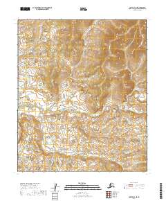
2019 Map of Nulato D-2 NE
USGS Topo · Published 2019About this map
The Yukon-Koyukuk interior region of Alaska, north of the Yukon River, is defined by its topographic complexity and extensive wetland systems in this 2019 survey. The terrain is structured by the Public Land Survey System grids of T6s R11e and T7s R11e, revealing a landscape where elevation changes and hydrographic patterns dictate the character of the land. While the region lacks formal named settlements or road infrastructure, the detailed contour intervals from the National Elevation Dataset show a highly textured wilderness. This map provides critical baseline data for understanding the hydrology and land boundaries within the T6s R10e and T6s R12e townships, serving as a primary resource for researchers studying the remote interior reaches of Alaska as they appeared in the early twenty-first century.
Find a feature on this map
6 named features on this map. Tap any name to fly to it.
Don’t see what you’re looking for? This feature index may not catch every label — zoom into the map to look around manually.
Map Details
Editions of this 2019 Nulato D-2 NE Map
This is the sole edition of this map. No revisions or reprints were ever made.
Other maps of this area

1945 · Nulato
USGS Topo · 1:250,000

1951 · Nulato
USGS Topo · 1:250,000

1951 · Kateel River
USGS Topo · 1:250,000

1952 · Nulato D-1
USGS Topo · 1:63,360

1952 · Kateel River A-2
USGS Topo · 1:63,360

1952 · Kateel River A-1
USGS Topo · 1:63,360

1952 · Nulato D-2
USGS Topo · 1:63,360

1952 · Nulato
USGS Topo · 1:250,000
1954 · Nulato D-2
USGS Topo · 1:63,360

1955 · Kateel River
USGS Topo · 1:250,000