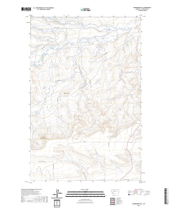
2024 Map of Nunemaker Hill
USGS Topo · Published 2024About this map
Nunemaker Hill and Eagle Point anchor this northern Montana landscape, where the high plains of Teton County are carved by a network of drainage coulees. The southwestern portion of the map is protected within the Blackfoot Valley Conservation Area, indicating a modern landscape dedicated to ecological preservation and rangeland management. The terrain is defined by the erosion patterns of Nunemaker Coulee, Wolf Coulee, and Bruce Coulee, which channel seasonal water toward Willow Creek and Deep Creek in the north.
Find a feature on this map
19 named features on this map. Tap any name to fly to it.
Don’t see what you’re looking for? This feature index may not catch every label — zoom into the map to look around manually.
Map Details
Editions of this 2024 Nunemaker Hill Map
This is the sole edition of this map. No revisions or reprints were ever made.
Other maps of this area

1920 · Choteau
USGS Topo · 1:125,000

1955 · Choteau
USGS Topo · 1:250,000

1957 · Choteau
USGS Topo · 1:250,000

1958 · Choteau
USGS Topo · 1:250,000

1960 · Bynum
USGS Topo · 1:62,500

1960 · Choteau
USGS Topo · 1:62,500

1960 · Gilman
USGS Topo · 1:62,500
1960 · Freezeout Lake
USGS Topo · 1:62,500

1962 · Choteau
USGS Topo · 1:250,000
1976 · Choteau
USGS Topo · 1:250,000